Broken Top Won’t Break Me.
After going out and hiking a few varying degrees of challenging hikes, I decided it was time to put myself to the challenge of a next level hike. I had heard from quite a few people that Broken Top would be challenging, but absolutely worth the sore legs and sweaty body.
The trail to Broken Top and No Name lake is roughly 15.2 miles round trip. However, for us, it was closer to 16 miles since we ventured off to the tippy-top to get the view of the whole world. If 15-16 miles seems too out of your walking range, luckily there is a three mile trail that families and less skilled adventurers can take alternatively. However, this route is only open for a short time midsummer when the snow has melted away enough to drive up. For directions and updates on the opening, check out AllTrails.com.
TAKE CAUTION FOR ALTERNATIVE ROUTE: The road leading to the three mile trailhead is very tough to drive on. I highly recommend only trucks, SUVs or cars with all-wheel drive attempt this route.
The Broken Top trailhead is about 30 miles outside of Bend on Forest Rd. 380 off of Cascade Lakes Hwy. Be sure to bring cash to purchase a day-use permit unless you have a Northwest Forest Pass already.
Once the car has been parked and permitted, before starting off on your adventure, double check that you’ve packed snacks, plenty of water (especially in the summer months), proper shoes (preferably waterproof), and I highly recommend dousing yourself in some form of mosquito repellent. The first two miles of the hike are in a heavily wooded area and the skeeters are thick. You’ll thank me later for stressing the necessary repellent.
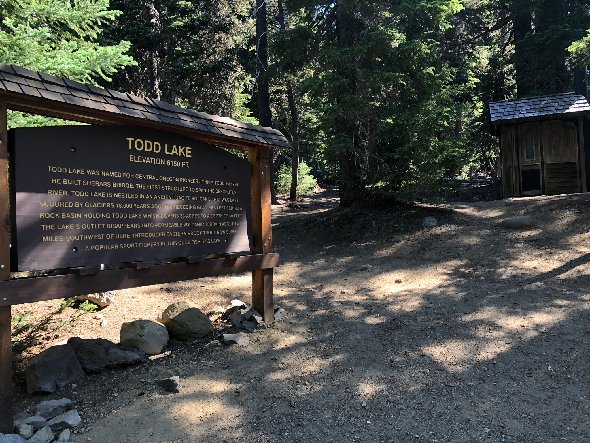
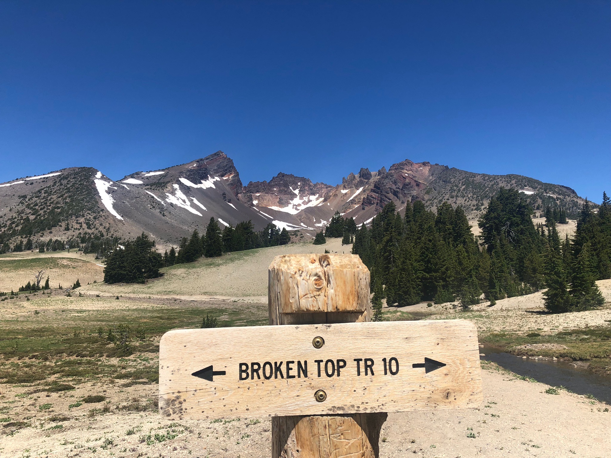
After checking the above list, it’s time to hit the trail. The first couple hundred yards lead you to a sign describing Todd Lake. Just to the right of this sign is the only bathroom on the trail. At this sign you will want to keep all the way right, otherwise you will end up on the path that to Todd Lake loop. You’ll know if you went the wrong way if you pass picnic tables. If you go the right way, you’ll run into another permit station that you are required to fill out and take with you.
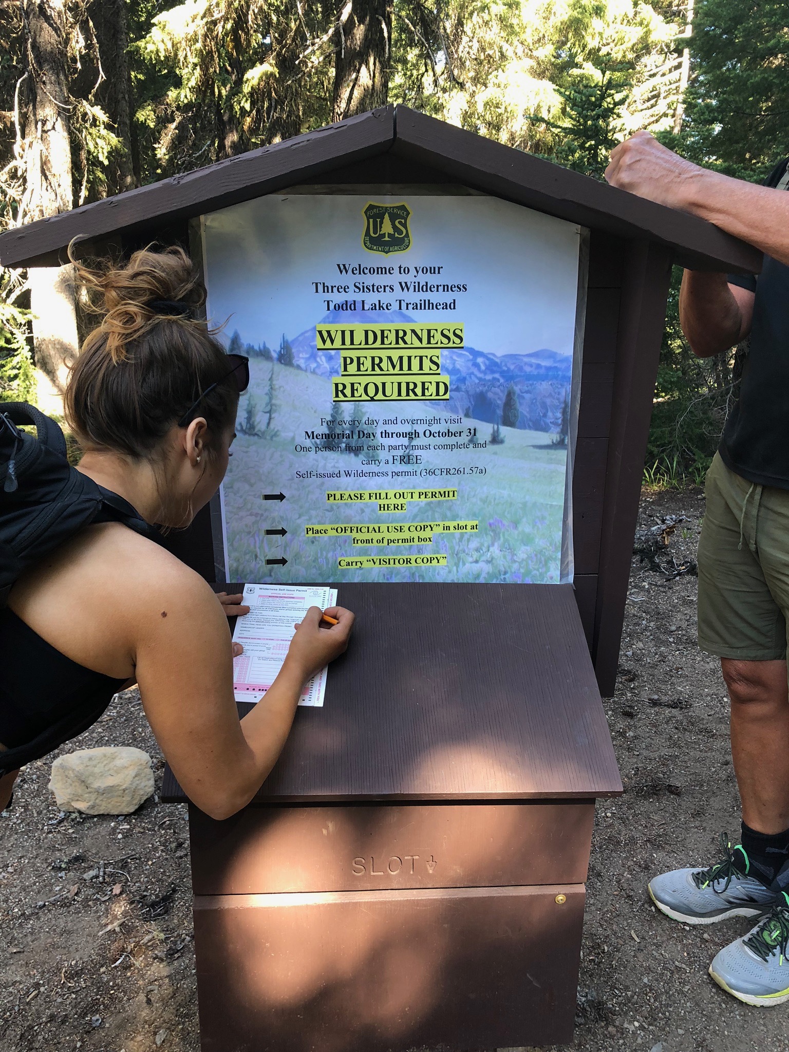
With permit in hand, now the adventure truly begins!
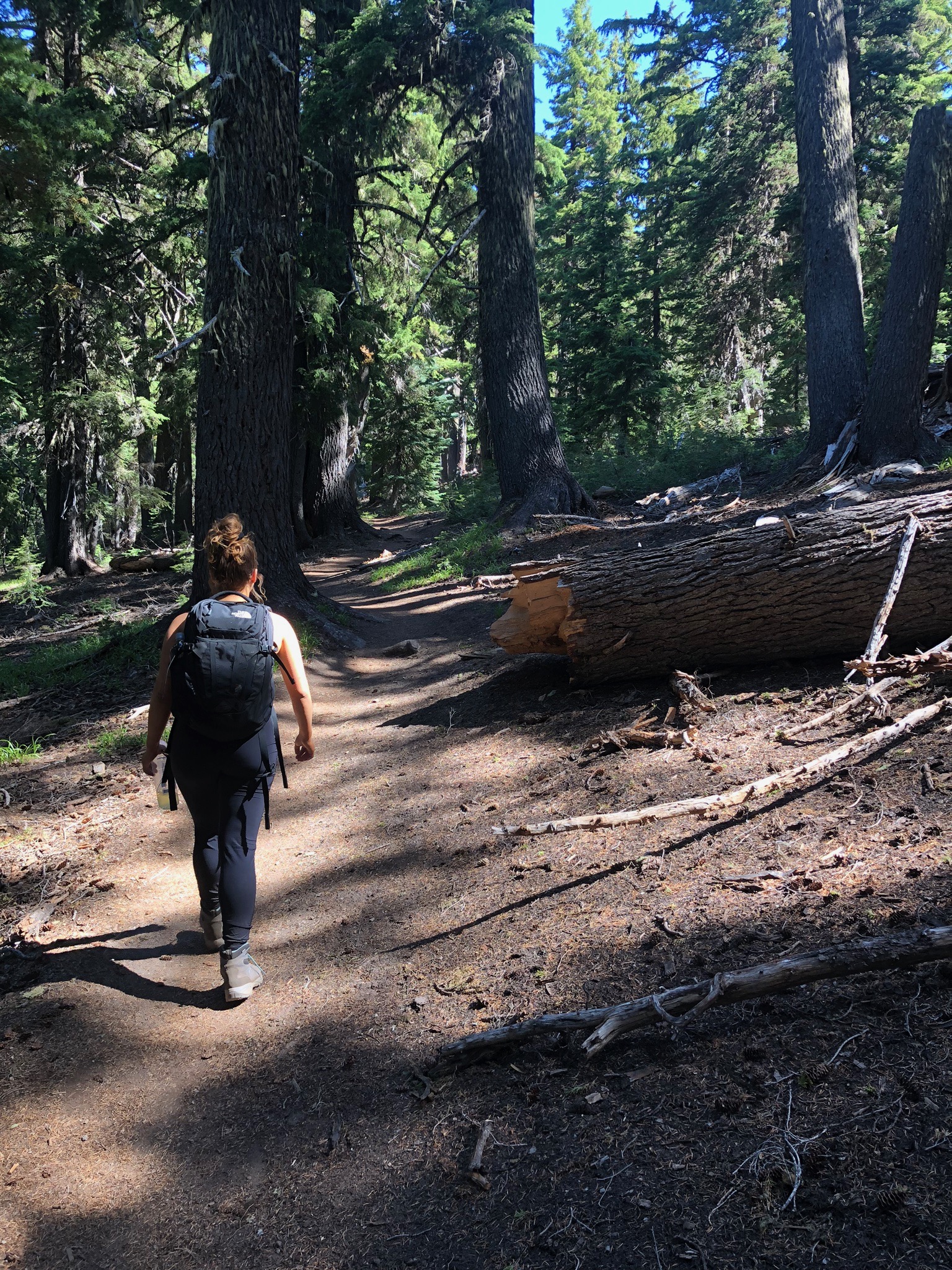
As mentioned before, the first couple of miles are in a forested area. This stretch of trail is steadily uphill, so be prepared to get your lungs and legs pumping. Even with the slight elevation change, I was surprised how winded I became when strolling at my normal pace. However, just as I started to acclimate, the trail starts to level out, even at times declining. This seemed like an advantage at the time until I realized that on the way back it would be uphill.
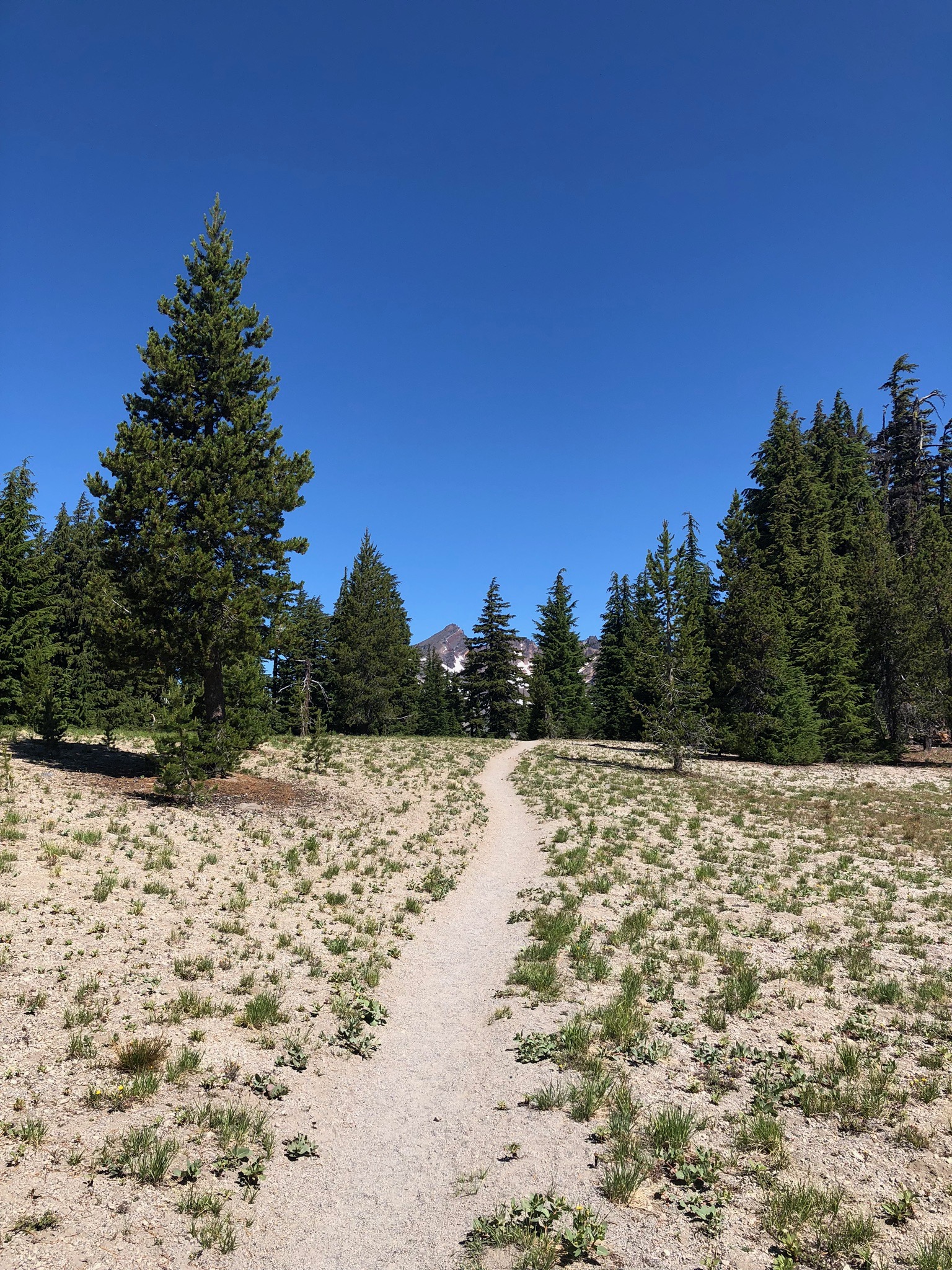
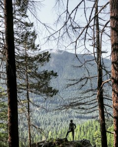
For the next couple of miles, Broken Top starts making its appearance, drawing you in with anticipation and excitement. The terrain around you changes at every turn, sometimes mimicking the typical high desert look and then changing into lush green pastures littered with flowers.
The trail is very straightforward and easy to follow until around mile 4.5. Here, you reach an intersection with a path going straight or to the left. According to the AllTrails app, it says to take the path to the left. However, we were feeling adventurous and decided to go straight.
The off-the-map-trail path took us to this gorgeous marshy area that had a stream running through it. This was perfect spot to slow down and take in the surrounding scene. Hundreds of butterflies occupied this little stream and made the moment almost sparkle. Mount Bachelor in the background did not make it hard on the eyes, either.
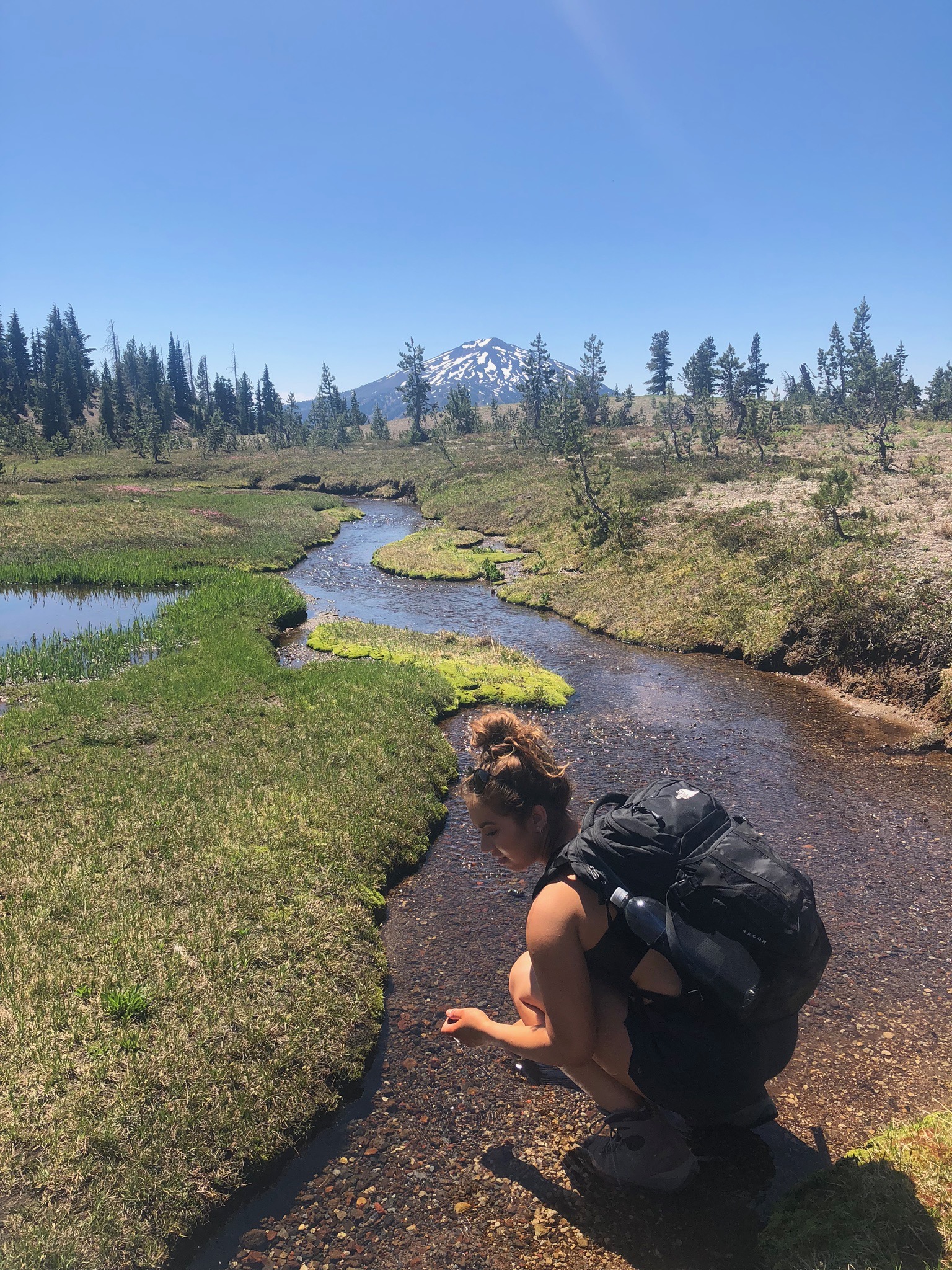
After hydrating and catching the breath that was stolen from the view, the trail eventually runs back into the AllTrails course.
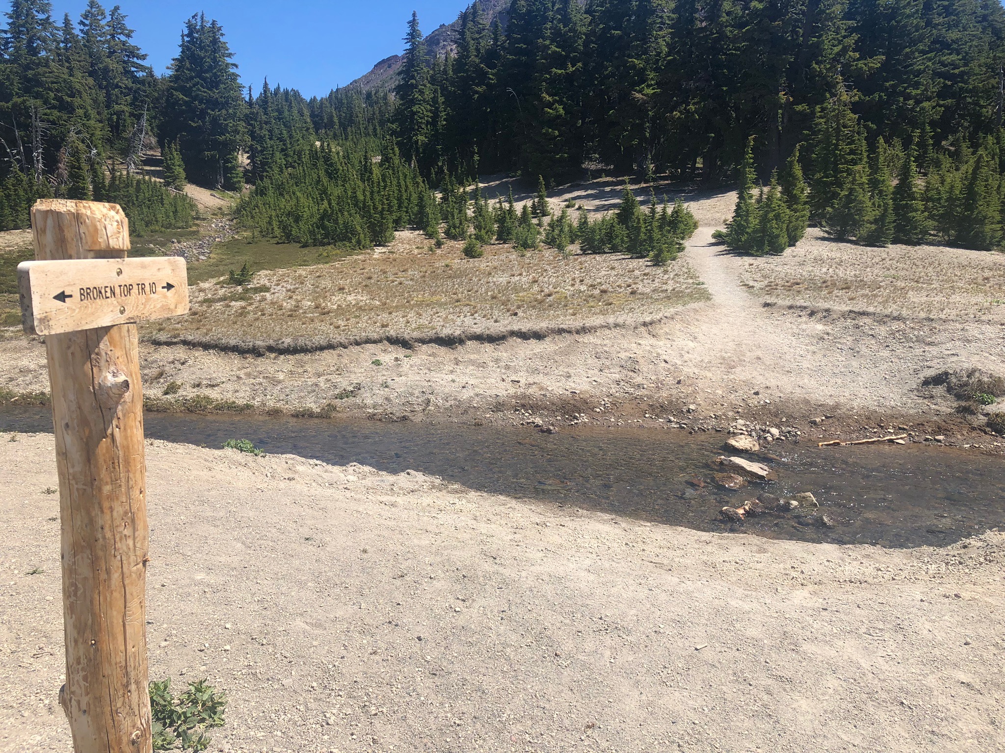
Less than a half of a mile ahead, a creek appears that you must cross in order to continue. This is where waterproof shoes will come in handy. To make it easier to cross, some larger rocks form a kind of pathway, but take serious caution here.
I give this warning only because on the way back down from the top, at this very intersection, I managed to slip on the rocks and fall pretty hard. I was lucky that I managed to get up and walk away with only a few bruises, but not everyone gets that lucky. So please take caution when crossing this area.
After crossing the creek safely, be sure to enjoy the last leg of the hike that is fairly flat, because at roughly mile 5, it is nothing but up. Personally, one of the biggest disadvantages to having most of the leg to the top being fairly flat is that it makes the last two miles a little tougher. The body may have been warmed up, but the mental preparation for the uphill battle got lost somewhere in the flat terrain. But! The show must go on!
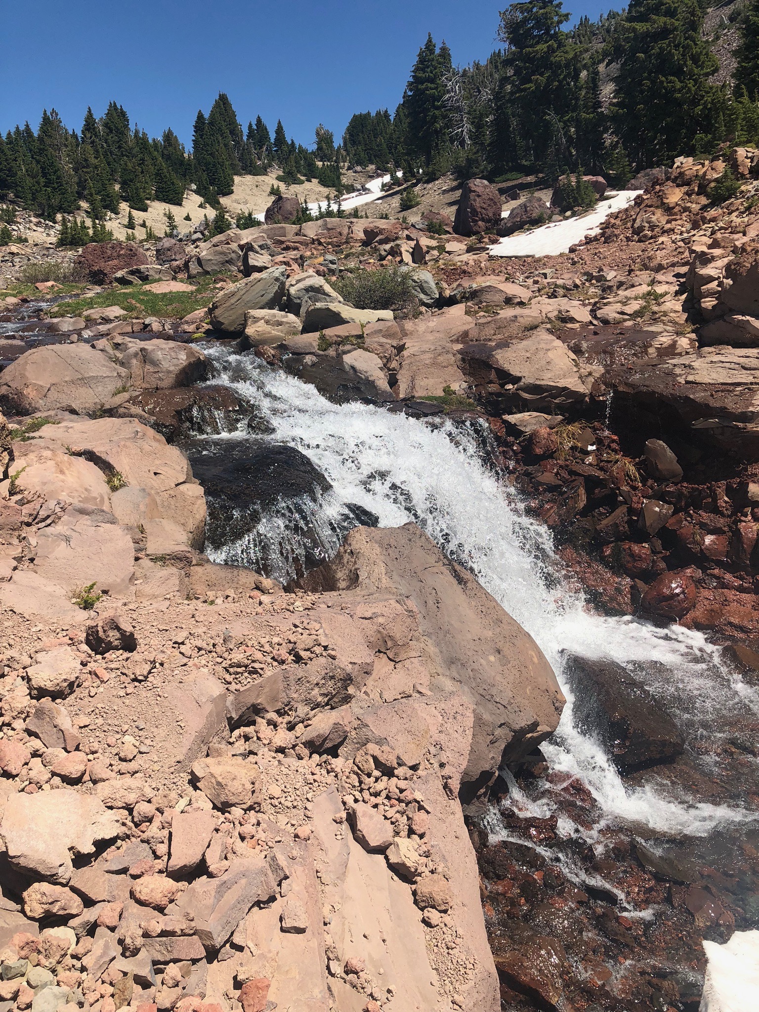
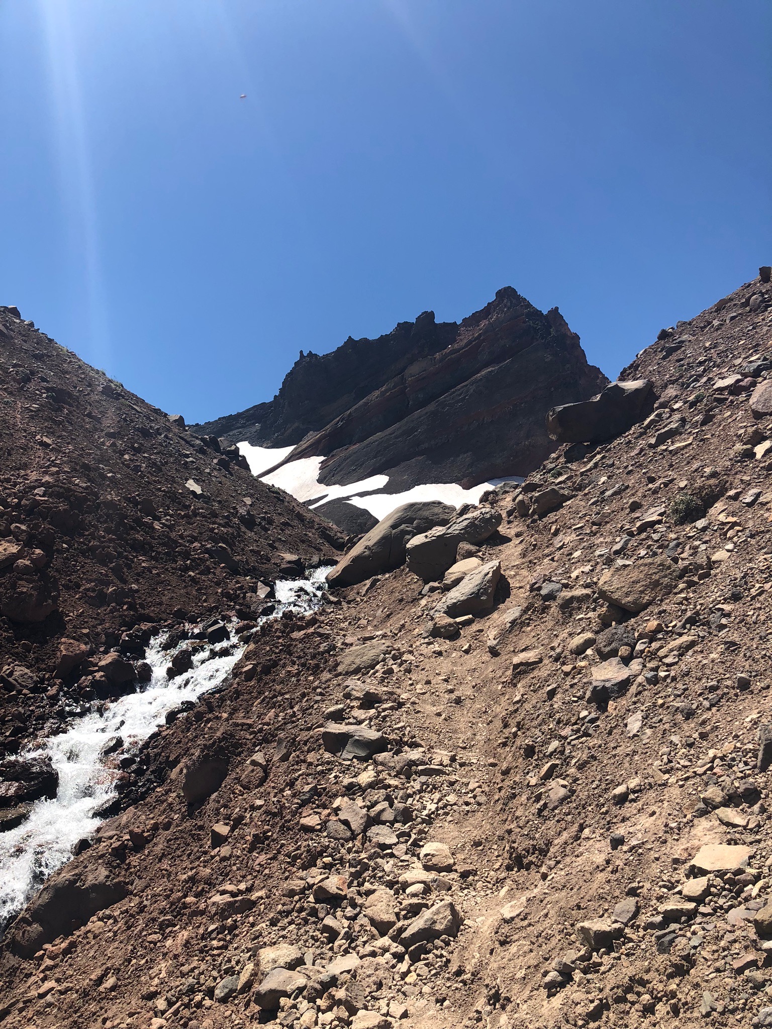
The benefit to this hike is that there are plenty of visual distractions to keep you from overthinking how deeply you’re breathing or how fiery your legs are. I am a giant fan of waterfalls of all sizes, so making this an excuse to catch my breath was an easy call.
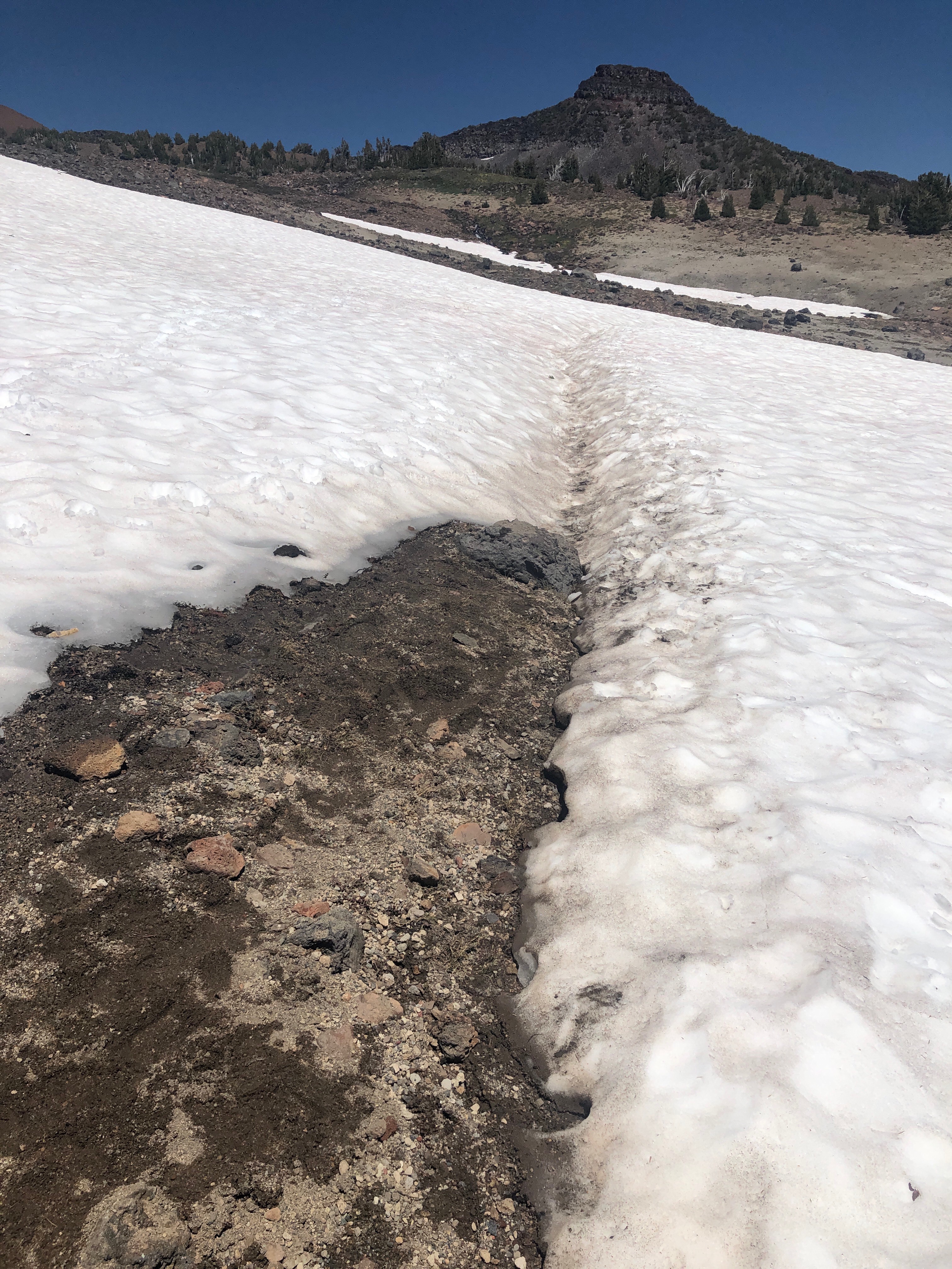
Since we did this hike in July, the snow started around mile 6. Take extra caution when crossing these paths because they are a bit slippery. The paths were not difficult to follow at this time due to being heavily trafficked during the summer months.
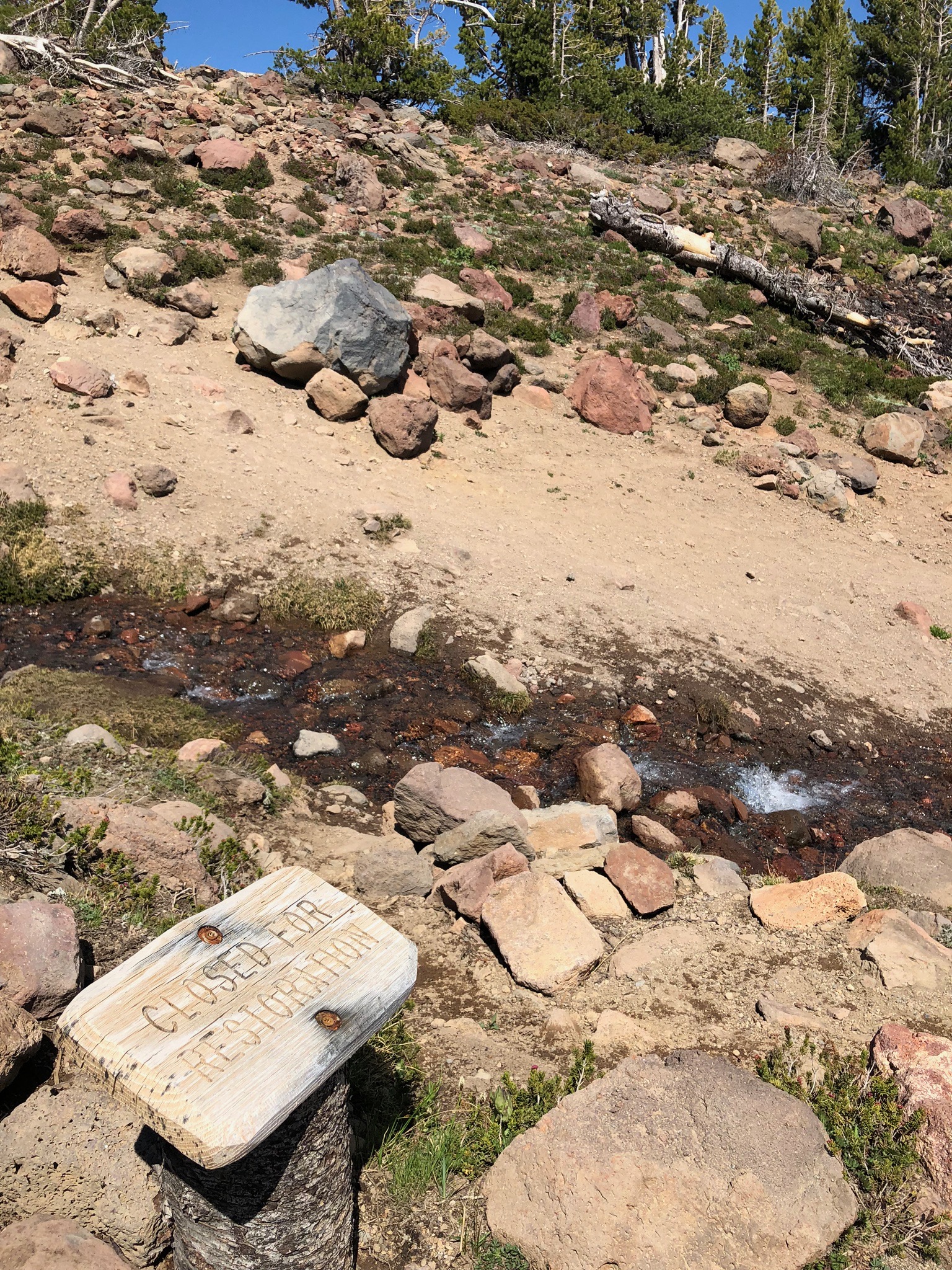
The only time I had a difficult time locating the trail was at the below image. This intersection is around 6.6 miles in. There is a small stream that runs through the trail, however there is a CLOSED FOR RESTORATION sign at the point that you want to cross in order to remain on the trail.
Al. Most. There.
The last half of a mile is mixed with snow and rocks. Take caution with each step. Although the anticipation to reach the top is high, you don’t want to rush up and twist an ankle.
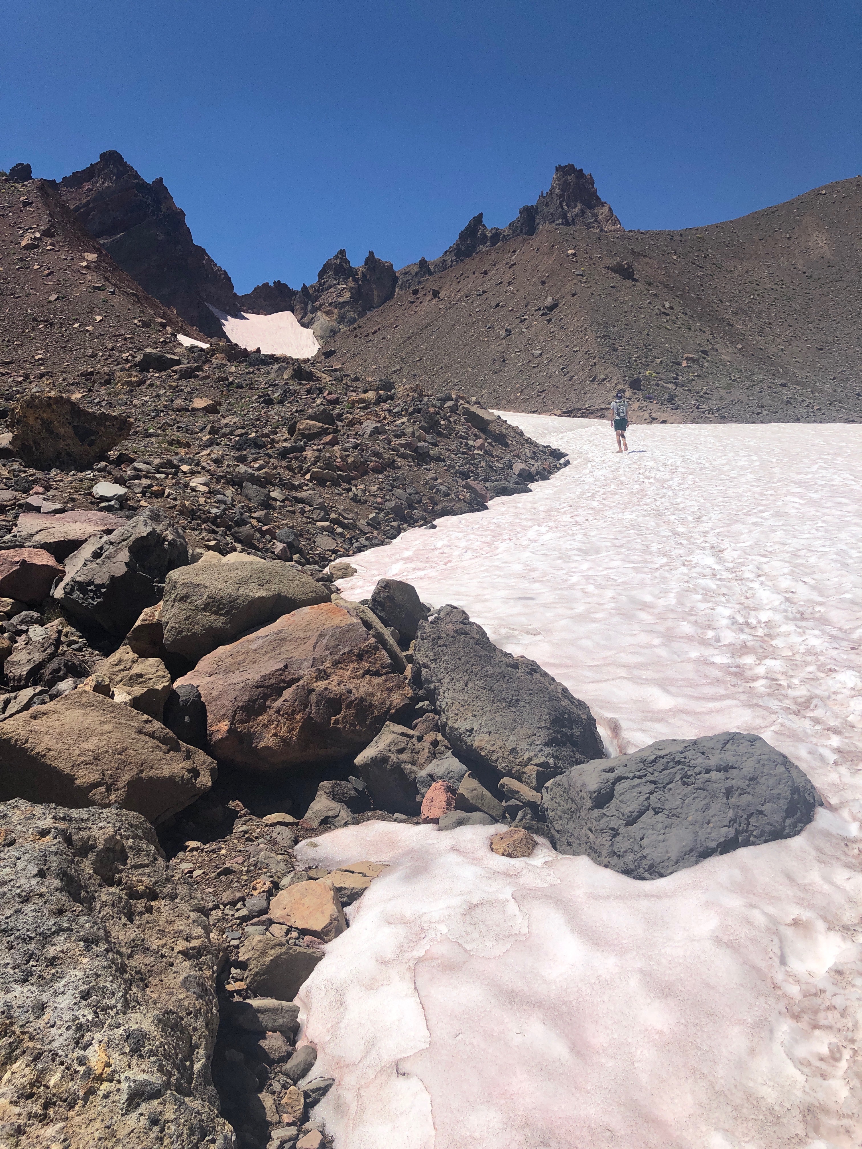
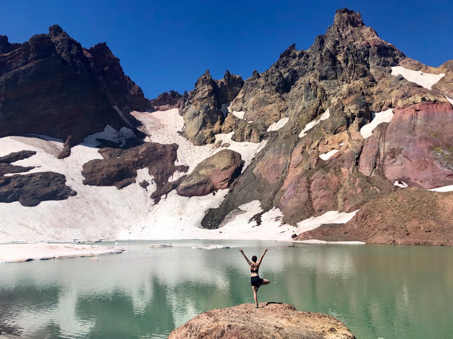
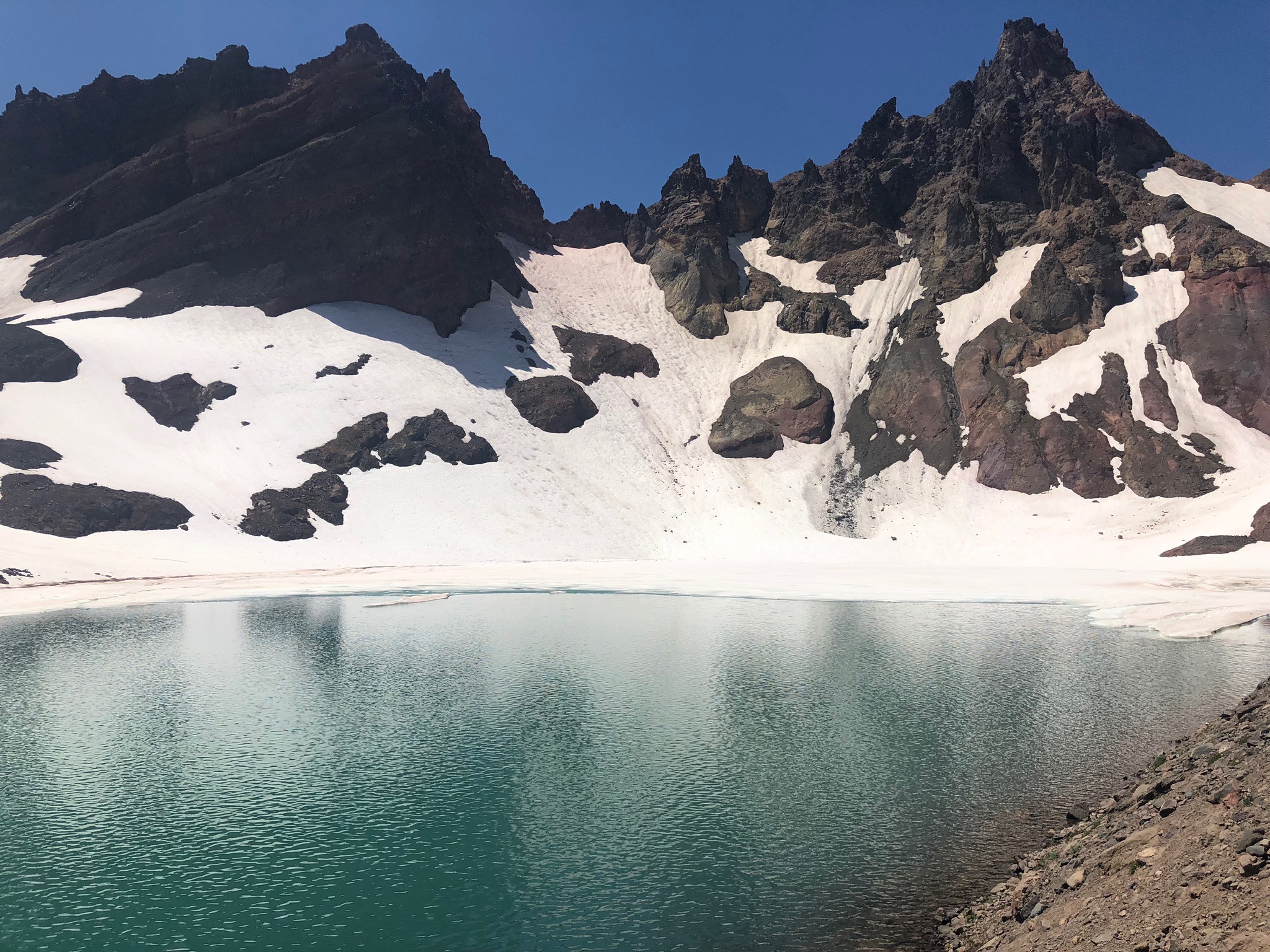
Coming up to the top and seeing No Name Lake was so overwhelming. After battling mosquitos, wading through a creek, and enduring the pounding sun, the exhaustion vanished and the surroundings sparkled. The lake wasn’t completely melted off, as it tends to be more in August, but it was the bluest blue and contrasted with the whitest, white snow. Every step of the 7 miles is worth the view.
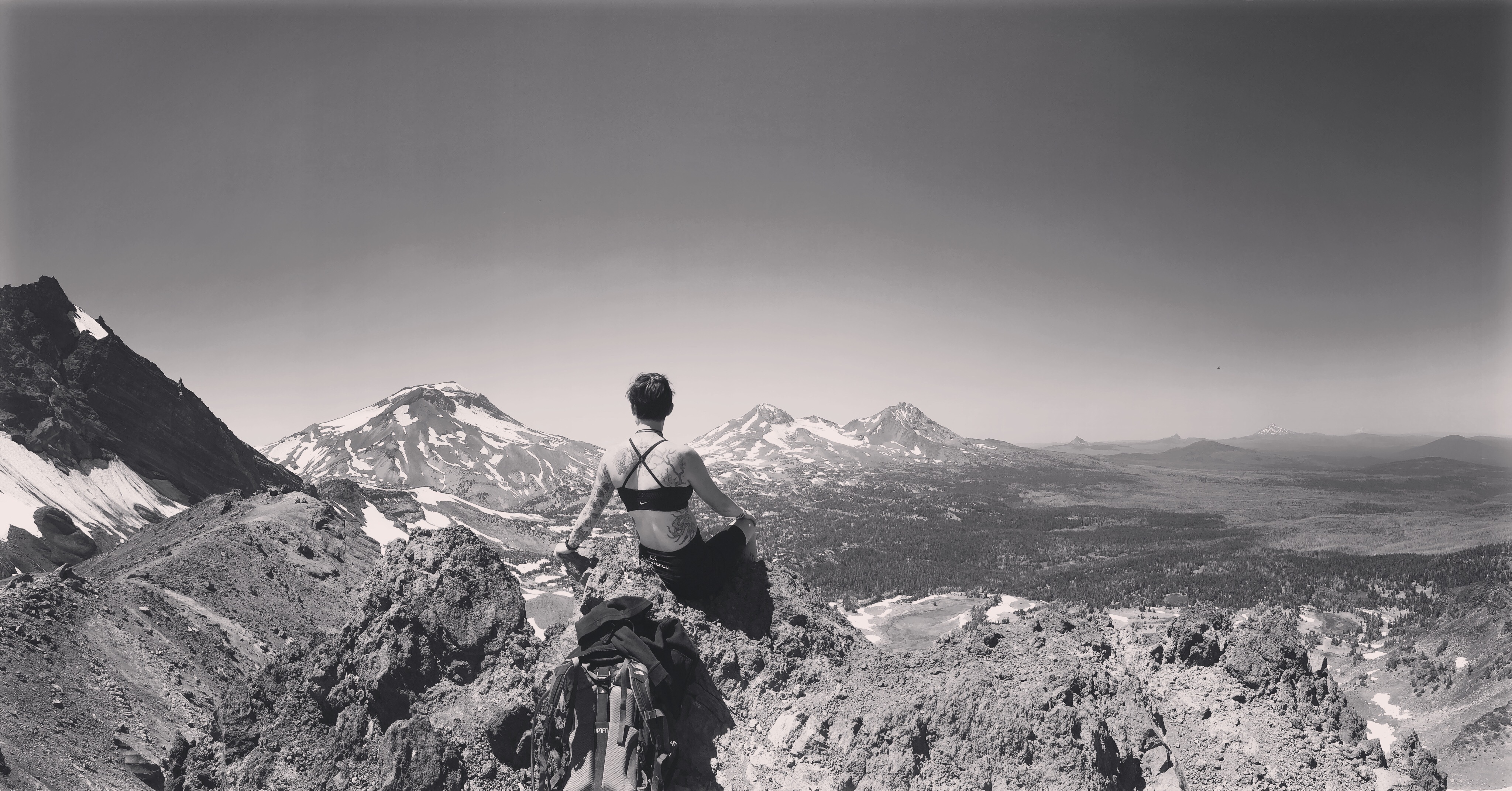
The view doesn’t stop there. If you have enough energy to power up to the tippy-top, absolutely do it. It’s a tough quarter-to-half mile straight up, but once at the top, you won’t regret it.
The day we hiked was so clear that from the top, every mountain to Mount St. Helens was clear as day. July in Oregon is just before fire season, so if you have the opportunity to go at this time of year, do it.
All in all, round trip was about 16 miles in seven hours, including the hour we lounged at the top. As briefly mentioned before, the hike back was a little more taxing on the body. The easy section on the way up turned into an uphill battle on the way down.
Again. Worth it.
Broken Top and No Name Lake turned out to be one of the most memorable hikes to date. It was my first lengthy hike that demonstrated how truly amazing our bodies are when you put your mind to it. More than anything, being able to see, what felt like, all of Oregon was beyond breathtaking.
Be sure to follow my blog to keep up with me as I explore Oregon. Next big stop: South Sister for my 30th birthday.
